Day 2 was the day I’d been dreading. It was the longest day of the week and the one with the highest elevation. When I’d originally plotted out the coast to coast route, I’d tried to divide the days as evenly as possible in miles. Because of accommodation issues, I ended up having a shorter first day than originally planned – and a longer second. It was only in the last few months that I looked at the elevation profile of each day and started to realise what I’d let myself in for in attempting to cross the entire Lake District in two days.

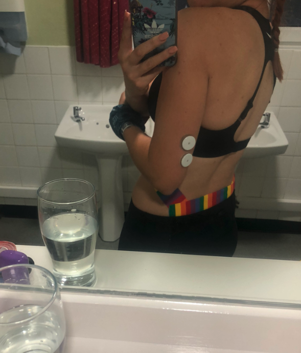
I was woken shortly after 3am in the YHA by a roommate knocking a book off her bed. I couldn’t get back to sleep after that, so I got up at 4:10am. It took me about an hour to pack my bag and prepare myself (applying RockTape to my chaffed back and BodyGlide to my feet and shoulders). By 5:10am, I was out the door and on my way.

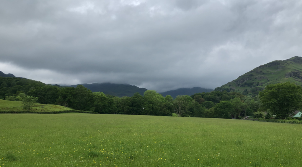
The first few miles were enjoyable – running downhill at dawn, enjoying the countryside before anybody else was out of bed. I ran past Seatoller, Borrowdale and Rosthwaite, carefully closing gates behind me so as not to disturb the world. After 5 miles, the first climb of the day began, and I was heading about 1600 feet up into clouds.

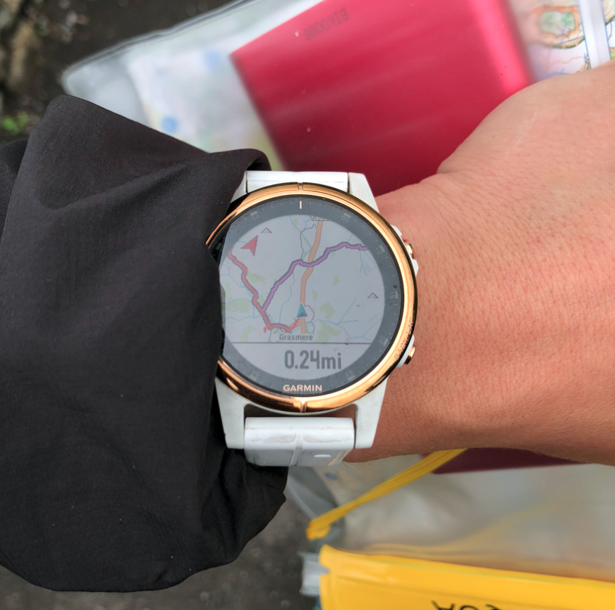
I reached the summit at about Mile 7, and the visibility was near zero. I turned on the spot and realised I didn’t know which direction I had come from or which way to head towards. I’d never understood how that was possible until I was on the top of that mountain. Thankfully, I had my watch on, with GPS and GLONASS (a Russian satellite-based navigation System), which became an absolute life saver. Before leaving home, I’d planned my routes for each day onto GarminConnect and had uploaded them to my watch. I couldn’t have been more glad of anything. Eventually, I began my descent, and despite wearing my watch, I still had doubts. I found myself veering off course at one point because I’d followed the path – but it wasn’t the right path. I had to begin to blindly trust my watch, as terrifying as that idea was, and just keep going.
The ground was wet and marshy: I kept stepping into water, and slipping on rocks. At one point I flew straight on my back, like an overturned turtle. At another point I fell right over a rock in front of me and submerged my glove in mud. I was getting fed up, but I kept going. Eventually, I came out of the clouds. I could see the descent towards Grasmere and the open land ahead of me. Just me and the sheep.

At mile 11, I hit Grasmere. Which, incidentally, was the first time I’d had phone service since the previous day. I hadn’t been able to let my mum or boyfriend know that I was okay. Obviously, I’d forgotten about the concept of landline telephones – but my boyfriend hadn’t, and he’d called up the YHA to see if I’d arrived, but they couldn’t tell him. From that point, I kicked myself about forgetting about telephones, and vowed to myself that I would get in contact each day.
As I absent mindedly messaged away, I realised I’d been following Footpath signs to Grasmere, when I actually wanted to skirt around it – I wasn’t due to stop there. And so I turned up the path I thought was the correct one… only it wasn’t. But by this point, I’d pulled out my map, knew where I was on it and knew that I could walk back to my route via a pub, where I could sit and charge my Garmin. That first climb had taken a lot out of me, and I hadn’t seen another soul for several hours. I was panicked about doing it all over again. Twice.
So shortly after Mile 12 I hit the Traveller’s Rest pub, and I went in. I stood for a moment, looking around. I was greeted by a young man behind the bar, who asked if I was staying there. I said no, and my indecision made me frozen to the spot. He said I didn’t have to have anything, and could just sit. Then he asked if I was okay. I must have looked like a deer caught in headlights. I said I was okay and walked slowly around to a table. The place was empty. I took off my bag and began charging my Garmin.
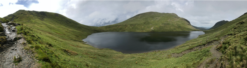
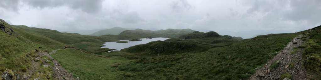
As an hour of me sitting there approached, my nerves were building. I went to the toilet a couple of times and dried my gloves under the hand drier. Eventually, I knew I had to leave – and off I went up the road, taking a right up Tongue Gill. The climb was gradual and scenic, and there were hikers. I wasn’t alone for this one. The clouds had lifted and so had my spirits. I overtook several couples, keen to tick another peak off my route. After 14 miles, I reached the summit (~1900ft) and the beautiful Grisedale Tarn came into view.
The sun was shining and the rocks were dry, so I began to run the descent, smiling and greeting every person I passed, which ended up being many. The descent ended up being about 4 miles long, and I loved it. I had a great time letting gravity pull my bag whilst hopping from rock to rock and running down the mountain. After 19 miles, I’d made it to Patterdale.


I was feeling a bit calmer by this point. I’d made two summits and I just had one to go, but I was acutely aware that it was the biggest peak of the day – and of the entire C2C route – and the weather was due to turn. I ended up ducking into another pub – The White Lion, where I sat and charged my Garmin again. I started to get cold quickly, and overheard a large group of walkers deciding to call it a day as heavy rain was about to set in. But I had a reservation to make in Shap, and it was about 4pm. I still had about 5.5 hours of daylight hours left. I had to crack on.
Immediately after leaving Patterdale, the rain came. I passed one group of school children making their way back down as I went up.

Just before Mile 21 is where things got hairy. It was a narrow path along a mountain, 1600ft up and with what felt like a sheer drop on the side. It was wet and windy, and I was suddenly petrified. But I’d made it this far – and as far as I knew, this was the only way across. I told myself that everyone else who had done the coast to coast had done this route; that I just needed to keep calm, tread carefully and put one foot in front of the other until I made it across. I couldn’t look at the view. I couldn’t look down. I focused all my energy and attention on the ground and on each step that I made. Eventually – and with great relief – I made it across the Dubhow Brow onto wide, even ground.
Suddenly, the landscape opened up and Angle Tarn came into view. I tried to appreciate the view across the water, but I struggled, knowing that I still had a few more miles before I’d reach the summit. Shortly after Mile 22, I was trudging through the marshy landscape, but the path had become less obvious, and after following what I thought was the right path, my watch buzzed with the dreaded ‘Off-course’ warning.
I swore, and tried looking around; nothing was clear. I tried retracing my steps and ended up cutting across the marshy land, because no available route was dry or clear anyway. I just wanted to be back on track. Eventually I hit a boundary line and walked along it. I didn’t know until now, looking at the satellite image, that I’d overshot the path I had needed. Eventually, I made it back on track, and continued the long, uphill slog towards the summit.
And this is when the clouds began to roll in over me. The rain had turned to hail and the wind picked up. I tried to keep moving swiftly, but I was battling against the wind. I tried to steady my feet, but kept being blown into the mountain. I was freezing and drenched to the bone. My Garmin battery threatened to give up; my GoPro battery did more than threaten. I crouched and managed to get my powerpack out to charge my watch. I gave up on the GoPro. Every ounce of strength and focus I had was spent on making it to the summit safely… and then making it down the other side. I began to despair as I watched the route on my watch lead towards a massive mountain ahead of me – and I began to plead with the world to let it be over. Let me get there and let me get down.
When I eventually reached the summit, I wasn’t aware of it. I couldn’t see anything. But unlike the poor visibility on the first climb of the day, where I became suddenly aware of how easy it would be to be lost to the world, I actually became thankful that I couldn’t see. I didn’t want to see how high I was and I didn’t want to see the potential drops on either side of me. I quietly acknowledged that I must have reached the summit when the ground beneath my feet began to slope downwards, but I didn’t feel accomplished, pleased, or in any way relieved. I was still out in the elements at the top of the highest peak on the coast to coast route – alone and with the end of the day drawing ever closer. I still had to climb down from 2,600ft.
The descent was the steepest I’d encountered all day. The rocks were wet and slippery, and I was tired and cold. I kept giving myself little pep talks like ‘you’ve done the peaks now, you’ve just got to get down and you’re on the home straight’ and ‘you’ve got this’. I would speak out into the wind. I could’ve bellowed it and nobody would’ve heard. But I had to focus on me and shrug off any thoughts that I was the last person crossing that mountain for the day. After an age, I emerged from the clouds and a deer leapt gracefully in front of me and down the mountainside – not even acknowledging my presence. I smiled for the first time in hours, even as I found myself envious of its footing and skill. About a mile later I saw another, grazing, which darted quickly when it saw me – but the ground was still very much technical.
At mile 26, the descent remained steep towards the Haweswater Reservoir. And I smiled and breathed a sigh of appreciation at the gate ahead of me. Civilisation. The appreciation was short-lived, however, as it became apparent that the ~4 miles along the Reservoir wasn’t a smooth track in the slightest – but rocks, uphills, downhills and almost constant technical terrain, with puddles and low branches. Every time I turned a corner and saw a rocky uphill I shouted out in anger. I lost count of how many times I shouted ‘are you ****ing kidding me?’ that afternoon. I’d been going for over 12 hours by this point and the rain wasn’t letting up. I felt so close to Shap and yet so bloody far.
Eventually, I got to Burn Banks and came across a telephone box. Shivering and dripping wet, I pulled out my phone, but I didn’t have the number for the hostel I was staying at (I was worried that no one would be there by the time I’d arrive, or that my room would be given to someone else since I was so late), but I did manage to get service and call my boyfriend. I quickly said that I was okay, safe, and down the mountain, but that it was 8pm and I still had over 4 miles to go until Shap, so I asked him to find the hostel number and call them to let them know that I was arriving. With hindsight, I should have waited in the telephone box. Because it later turned out that once my boyfriend had called the hostel, and they’d said my room was fine, they called him back and offered to pick me up, since they were worried about the severe weather and night closing in.
Unfortunately, when my boyfriend relayed this, I didn’t receive the message, or feel my phone vibrate. I’d already tucked it back into my waterproof pocket, taken a deep breath, and ploughed into the forest – away from Burn Banks and its telephone box.
And naturally, those last 4.5 miles were far from roads or straight forward paths. They started off in a darkening wooded area, which I marched through as fast as my legs would carry me. The path progressed to styles and open farmland, with fields full of cows and warnings to dog owners. The day’s downpour made every step a more difficult trudge. The landscape had very quickly changed from mountains to fields, farmlands and flowers – one field full of yellow flowers would have made a great shot if I’d had any will power or finger dexterity left to change the battery in my camera, but sadly I did not.
At Mile 34, I hit Shap Abbey, and knew I must be close. Just one more mile. Immediately past the Abbey, my watch led me straight ahead – straight up a steep field. I told it to f*** off, and followed the road instead. While this would lengthen the route very slightly, it was a more gradual incline and I felt safer following the roads, as they sky was darkening and it was about 9:20pm!
At Mile 35, I stood outside the sign saying ‘ING Lodge’. I looked left and right, trying to guess which way the entrance was. I went left. I stopped my Garmin. I suddenly felt very low, and tried to pull out my testing kit whilst trying to find the front door. I found it and somehow managed to test with frozen fingers, relieved to see that my blood sugar wasn’t low. I rang the door-bell, and a very friendly, welcoming and smiling Eeva opened the door to me. I must have looked like a drowned rat. I was shaking, and struggled to untie my laces. She offered me a warm dinner – and I gratefully accepted a bowl of broccoli (staying low carb) which she cooked for me whilst I showered.
I was too cold to send messages other than a scrambled mess of ‘made it to the hostel’. I showered for an age until I stopped shivering. But as soon as the water stopped, I started shivering again. So I showered again. When I eventually got out, I put the warmest clothes I had on (a tracksuit and hoody) and looked at my feet. I had at least 10 blisters. I limped my way downstairs and tucked into the broccoli and Eeva also made me a pot of tea to help warm me up. I made my way back upstairs and put everything on charge and crawled into bed, still trying to warm up.
